

The Boreal Frontier: Carbon Reservoir or Climate Wildcard?
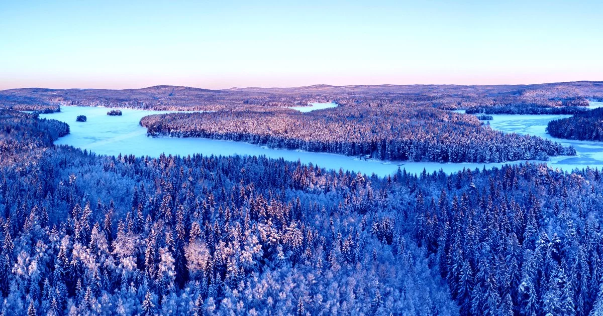
The boreal forests—those vast, subarctic woodlands girdling the northern hemisphere—are not the static, silent sentinels of old. Recent satellite analysis, spanning 35 years of Landsat data, reveals a biome in motion: the world’s boreal belt has expanded by 12 percent and is migrating poleward at an astonishing rate of 32 kilometres per decade. This shift is not merely a cartographic curiosity; it is a seismic event for global carbon cycles, economic strategy, and geopolitical calculus.
Beneath the green canopy, a generational turnover is underway. Younger stands now dominate, theoretically boosting the annual carbon sequestration capacity to as much as 5.9 gigatonnes—enough, in principle, to dwarf the current voluntary carbon market’s annual demand. Yet, this potential bounty is shadowed by the spectres of wildfire, pestilence, and drought. The boreal’s future role as either a climate stabilizer or a risk amplifier hinges on the decisions made by both public and private actors in the coming decade.
Remote Sensing, Digital Twins, and the New Forest Intelligence
The transformation of the boreal is being mapped, measured, and modeled with unprecedented fidelity. The confluence of continuous Landsat archives, daily PlanetScope revisits, and the imminent arrival of hyperspectral cubes is rendering high-latency forestry inventories obsolete. The economics of earth observation have matured: pay-per-use analytics now lower the barrier for insurers, carbon registries, and timber real estate investment trusts, democratizing access to actionable forest intelligence.
AI has migrated to the edge—literally. Portable models now run on drones and low-earth-orbit satellites, enabling tree-level species identification and fuel-load estimation in near real-time. Detection-to-decision cycles that once spanned months now compress into days, a leap that transforms not only forest management but also risk pricing and disaster response.
Perhaps most transformative is the emergence of carbon-stock digital twins. By fusing lidar, synthetic aperture radar, and atmospheric data, these models offer granular, auditable carbon bookkeeping. The prospect of API-addressable forest “baselines” is no longer theoretical; it is fast becoming infrastructure, as indispensable to carbon markets as indices are to finance. Cross-industry data exchanges—integrating IoT sensor grids from utilities, telcos, and mining operators—promise early-warning systems for fire and permafrost degradation, knitting together disparate sectors in a shared ecological fate.
Economic, Strategic, and Geopolitical Reverberations
The implications of a shifting boreal are as vast as the forests themselves:
- Carbon markets could be upended. Should the upper-bound sequestration estimate be realized and verified, boreal credits might flood the voluntary market, compressing prices and intensifying scrutiny of project quality. Corporates would be wise to diversify geographically, hedging against biome-specific volatility.
- Timber supply chains face a paradox: younger, faster-growing stands mean more fibre throughput, but also shorter rotation cycles and heightened capex uncertainty for pulp, packaging, and biomass producers.
- Insurance and reinsurance models are overdue for recalibration. Northward migration redraws wildfire hazard maps, and capital models anchored to historical loss ratios risk underestimating tail events. Parametric products, anchored to satellite-derived fuel-load indices, are emerging as a sophisticated response.
- Sovereign risk and geopolitics are in play. Expansion is concentrated in Canada, Russia, and the Nordics—nations whose fiscal futures are increasingly tethered to monetizing natural capital. Resource nationalism may manifest in data-export restrictions or bespoke carbon-credit custody rules, with global supply and compliance pathways hanging in the balance.
- ESG disclosure regimes are tightening. The EU’s CSRD and the SEC’s proposed climate rule elevate Scope 3 obligations, compelling firms reliant on boreal offsets to audit permanence assumptions and buffer for wildfire liabilities.
Navigating the Boreal Era: Strategic Imperatives
The boreal’s flux demands a new playbook. Dynamic carbon-asset strategies must supplant static offsets, leveraging remote-sensing verification to secure preferential issuance and de-risk reputational exposure. Supply-chain executives should map dependencies on boreal raw materials, embedding wildfire scenarios into inventory optimization. Insurers must recalibrate catastrophe models, integrating machine-learning fire-spread simulations informed by near-real-time satellite data.
Opportunities abound for those who move early: strategic stakes in geospatial-analytics startups, proactive engagement with policymakers on standardized carbon-accounting protocols, and support for open-data initiatives that fuse public and private sensor networks. Meanwhile, vigilance is warranted—especially regarding Russian and Canadian legislation that could reshape carbon-credit exports and Arctic trade routes, as boreal dynamics and polar ice melt become ever more entangled.
The boreal forest, once a distant green band on the map, now sits at the fulcrum of climate strategy, economic opportunity, and systemic risk. Organizations that harness the power of high-resolution earth observation and embrace adaptive governance will not merely weather this transformation—they will shape it.

 By
By
 By
By
 By
By


 By
By