

Instagram’s Map Layer: Charting the Next Frontier in Geo-Social Commerce
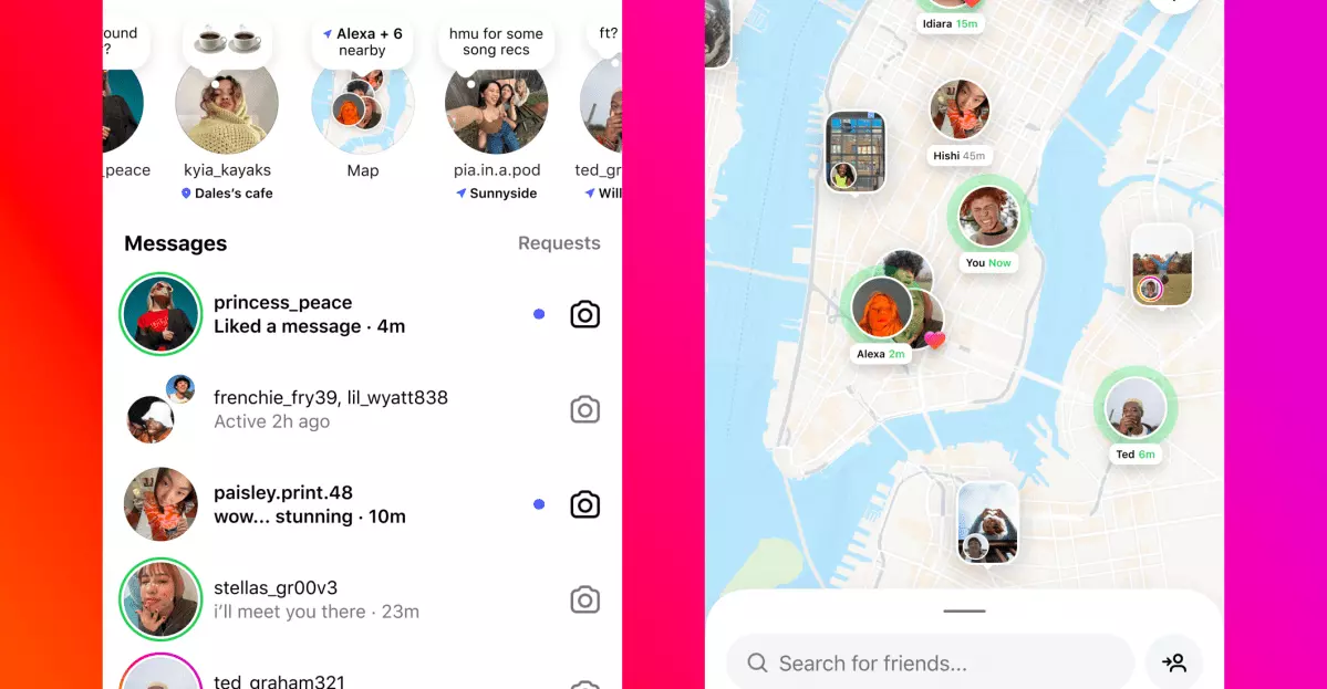
Instagram’s latest move—a quietly introduced opt-in Map layer—signals a subtle yet seismic shift in the social media landscape. By allowing users to explore posts, Stories, and Reels geo-tagged by friends and creators, the platform is not merely aping Snapchat’s Snap Map. Instead, it is methodically constructing a new digital topography where every location tag becomes a node in a living, breathing “geo-spatial graph.” This development is not just a technical tweak; it is a calculated step toward redefining how we discover, interact, and transact in the physical world through the digital lens.
From Static Tags to Dynamic Discovery: The Geo-Spatial Graph Emerges
Instagram’s transformation of static geo-tags into dynamic, discoverable map points marks a watershed in the evolution of social platforms. This is not a simple UI refresh; it is the birth of a new connective tissue that links social intent to physical context. The architecture leverages:
- Edge computing and on-device privacy controls: By ensuring live tracking is strictly opt-in and processed largely on the client side, Meta aligns with the privacy frameworks championed by Apple and Google, while reducing backend data loads.
- Cross-app synergy: The potential for federated map data across WhatsApp and Facebook Groups hints at a broader, family-wide location layer—one that could challenge Snap’s early lead and prefigure a unified Meta geo-ecosystem.
- Strategic parity: With Snap Maps and TikTok’s “Nearby” feed pulling in younger audiences, Instagram’s Map is less about novelty and more about retaining user engagement and attention.
This shift is not occurring in a vacuum. The move toward a geo-spatial graph is both a defensive and offensive maneuver, positioning Instagram to remain relevant as the digital and physical worlds continue to entwine.
Monetization, Data Moats, and the New Economics of Place
The implications for advertisers and brands are profound. A persistent, interactive map surface unlocks a new realm of hyper-local commerce:
- Sponsored pins and AR coupons: The map becomes prime real estate for local businesses, offering “tap-to-order” experiences and in-feed augmented reality promotions.
- Offline attribution: By linking digital impressions to real-world foot traffic, Instagram offers brick-and-mortar advertisers a premium metric—one that could command higher CPMs and drive more efficient ad spend.
- First-party data moat: Even with opt-in constraints, aggregated location metadata fortifies Meta’s targeting algorithms, creating a competitive advantage as third-party cookies and device IDs fade into obsolescence.
For brands and retailers, the message is clear: audit your geo-tag strategy now, as early movers in sponsored map placements will enjoy lower bid prices before the market matures.
Privacy, Trust, and the High-Stakes Calculus of Safety
The rollout has not been without controversy. Early adopters have voiced concerns about privacy and safety, drawing parallels to past missteps in location sharing. Instagram’s leadership, notably Adam Mosseri, has responded with clarifications and promises of UI improvements, but the stakes remain high:
- Vulnerable-user calculus: The risk of accidental exposure—particularly for at-risk individuals—remains a flashpoint. NGOs and legal advocates are poised to scrutinize every toggle and default setting.
- Differential privacy as a feature: Instagram has an opportunity to lead by integrating location blurring or time-delay algorithms, turning regulatory compliance into a competitive differentiator.
- ESG and social impact: As asset managers increasingly weigh social responsibility in their portfolios, visible progress on user safety could influence institutional investment and broader market sentiment.
This is not merely a matter of optics. The balance between innovation and trust will determine whether Instagram’s map becomes a vibrant marketplace or a cautionary tale.
The Road Ahead: Spatial Computing, Localism, and the Platformization of Place
Instagram’s Map layer is more than a feature—it is an early stake in the ground for the coming era of spatial computing. As AR headsets from Apple and Meta inch closer to mainstream adoption, a richly populated location graph will be essential for immersive, context-aware experiences. Meanwhile, the resurgence of neighborhood commerce and the demand for “near me” discovery in a post-pandemic, inflationary world give this move immediate economic relevance.
For decision-makers—be they brands, start-ups, regulators, or investors—the imperative is to adapt quickly. The next competitive frontier will be won by those who can blend spatial data, commerce, and safety with agility and credibility. In this unfolding landscape, Instagram’s Map is not just a new surface; it is the opening gambit in a high-stakes game where the boundaries between online and offline are redrawn in real time.

 By
By
 By
By
 By
By

 By
By
 By
By

 By
By