

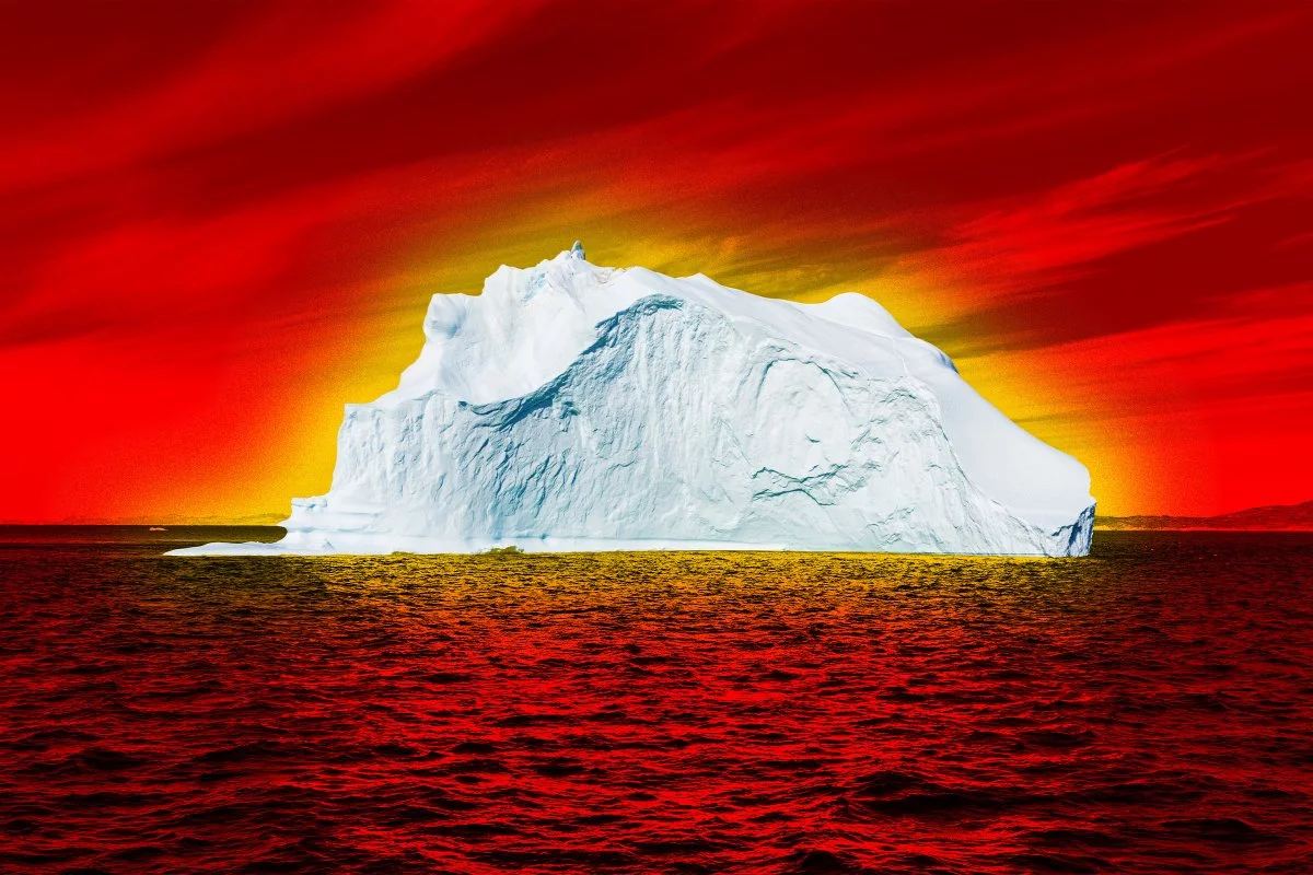
A faster-calving Greenland is rewriting the Arctic operating map
The new Nature study led by researchers at the Technical University of Denmark lands as more than a climate datapoint—it reads like an operational briefing for anyone with exposure to Arctic logistics, offshore assets, or high-latitude risk. The headline finding is stark: iceberg calving from Northeast Greenland has quadrupled since 2000, a shift linked to glacier destabilization and the retreat of protective sea ice that historically acted as a buttress and buffer.
That change is not confined to the fjords where ice breaks away. It propagates outward into the Fram Strait, a strategic gateway between Greenland and Svalbard that functions as a key corridor for Arctic circulation—and, increasingly, for maritime ambition. More icebergs moving through this chokepoint translates into a denser field of hazards for vessels, a more complex planning environment for operators, and a new baseline for insurers and regulators assessing what “normal” looks like north of 70°N.
The study’s deeper significance is systemic: it documents how warming-driven cryosphere shifts can rapidly cascade into ocean conditions, navigation risk, and seabed ecology. For business and technology leaders, the message is not simply that the Arctic is changing—it is that it is changing in ways that demand instrumentation, prediction, and governance at a higher level of sophistication.
Iceberg risk becomes a data-and-automation problem, not just a seamanship problem
As iceberg volumes rise, the competitive edge shifts toward organizations that can see earlier, model better, and respond faster. The study’s integration of four decades of satellite imagery, sea-ice modeling, and shipboard logs underscores the maturity of multi-source monitoring—and highlights how quickly iceberg risk management is becoming a data fusion challenge.
For maritime technology providers and shipping operators, the practical direction of travel is clear: AI-driven predictive analytics that can ingest heterogeneous streams and output actionable forecasts at operational tempo. The most valuable systems will not be single-sensor solutions, but platforms that combine:
- Satellite SAR for all-weather, day-night detection
- LiDAR and optical imagery where conditions allow high-resolution classification
- AIS and route telemetry to contextualize vessel exposure and near-miss patterns
- In situ sensors and buoys to validate drift models and local currents
- Sea-ice and ocean models to anticipate how wind, eddies, and meltwater influence trajectories
The next step is autonomy. The Arctic is unforgiving to human-only monitoring cycles, and the economics of persistent coverage favor unmanned systems. The study’s implications align with a growing operational logic: unmanned surface vessels (USVs) and underwater drones equipped with sonar and imaging can map iceberg geometry below the waterline—critical because the most dangerous mass is often unseen. In parallel, adaptive navigation software capable of automated collision-avoidance maneuvers is moving from “nice-to-have” to a credible safety requirement, especially as traffic increases and the margin for error narrows.
This is also a materials and design story. More encounters and tighter routing windows will intensify demand for hull reinforcement innovations, improved compartmentalization, and cold-resilient systems engineering—areas where classification societies, shipyards, and component suppliers will face rising scrutiny.
Supply chains, insurance, and Arctic finance recalibrate around a harsher baseline
The Fram Strait’s growing iceberg throughput has immediate commercial consequences because it sits at the intersection of route optimization and geopolitical interest. While the Arctic is often framed as a shortcut between Europe and Asia, the operational reality is that variability—not distance—sets the cost curve. Quadrupled iceberg activity raises the probability of:
- Rerouting and schedule disruption, with knock-on effects for inventory and contractual penalties
- Higher fuel burn from detours and speed changes to maintain safety margins
- Port and terminal congestion when Arctic windows tighten unexpectedly
- Operational delays that ripple into multimodal networks and just-in-time supply chains
For insurers, the direction is equally straightforward. Underwriters will be pressured to update actuarial assumptions as iceberg hazards intensify, likely translating into higher marine insurance premiums for vessels operating at high latitudes and stricter requirements for continuous monitoring. Financial institutions underwriting Arctic infrastructure—ports, subsea cables, offshore platforms—are likely to push for more explicit ice-risk disclosure, potentially embedding monitoring and response capabilities into loan covenants and project governance.
Energy and offshore development face a particularly sharp edge: iceberg variability can disrupt installation schedules, increase standby costs for specialized vessels, and complicate safety cases. The study effectively argues that granular iceberg risk must migrate from operational planning into project finance models, where it can be stress-tested alongside commodity prices, regulatory change, and geopolitical volatility.
A surprising seabed dividend: dropstones as biodiversity infrastructure and biotech signal
The study’s second narrative is less intuitive but strategically important: as icebergs melt, they deposit “dropstones”—rocks carried by ice and released onto the deep-sea floor. In abyssal environments typically dominated by soft sediment, these stones become rare hard substrates, enabling colonization by sponges, anemones, and other benthic communities. What looks like debris from a navigation perspective becomes, ecologically, a form of habitat infrastructure.
This matters for two reasons. First, it reframes Arctic change as not only loss, but also reorganization—new ecological niches, new community structures, and potentially altered carbon and nutrient dynamics. These benthic assemblages can contribute to ecosystem services such as carbon sequestration and nutrient cycling, strengthening the case for more rigorous valuation of Arctic natural capital and, potentially, future blue-carbon accounting frameworks.
Second, it opens a door for biotechnology and bioprospecting. Cold-adapted organisms—particularly sponges and cnidarians—have a history of yielding bioactive compounds with pharmaceutical potential. If dropstone habitats expand and diversify, they may become focal points for early-stage research partnerships between marine institutes and drug discovery programs. That opportunity, however, arrives with governance complexity: increased interest can increase disturbance.
Regulators and NGOs are likely to press for stronger stewardship, including “no net loss” expectations and tighter controls on activities that physically disrupt the seabed—ranging from survey work to subsea installations. Companies operating in the region will need environmental strategies that are not performative but measurable: monitoring baselines, minimizing footprint, and demonstrating compliance in data-rich ways.
The study ultimately portrays an Arctic where risk and opportunity are rising together—icebergs multiplying in the shipping lanes while new habitats assemble on the ocean floor. The organizations best positioned for this frontier will be those that treat Arctic change as a systems problem: instrumented, modeled, insured, and governed with the same seriousness as any other critical operating theater.

 By
By
 By
By
 By
By

 By
By
 By
By

 By
By