

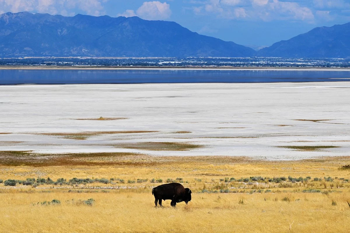
A hidden freshwater system beneath a saline icon—and why it matters now
Airborne electromagnetic (AEM) surveying over parts of Utah’s Great Salt Lake has surfaced an unexpected result with far-reaching implications: a substantial layer of fresh groundwater appears to sit beneath the lake’s saline waters, forming what researchers describe as a freshwater “lens.” Led by University of Utah geophysicist Michael Zhdanov, the team traced electrical conductivity along a 154-mile transect, using the fundamental contrast between resistive freshwater and highly conductive brine to map subsurface structure at scale.
The discovery is notable not merely because it suggests more freshwater than classical models predicted, but because it hints at a different hydrogeological engine operating beneath terminal saline basins. Traditional thinking generally confines freshwater influence to peripheral sediments and shallow inflows, assuming density stratification and mixing dynamics would limit freshwater persistence under a briny lake. The new conductivity patterns imply something more expansive: freshwater may be arriving through deeper subsurface pathways, potentially extending well beyond the margins that have historically framed Great Salt Lake water-balance debates.
Equally striking is the reported variability in basement depth—from several hundred yards to more than 2.5 miles—a structural complexity that could create the conditions for freshwater storage and movement at scales not previously quantified. The current footprint remains limited, and the work is best understood as a high-confidence signal rather than a final inventory. Still, in a region where water scarcity is increasingly a defining economic constraint, even the possibility of a large, concealed freshwater body changes the conversation.
The technology shift: AEM, 3D inversion, and the rise of geophysical water intelligence
This development underscores a broader trend in environmental analytics: hydrology is becoming a remote-sensing and computation-led discipline, not solely a borehole-and-sampling enterprise. AEM platforms can cover large areas quickly, capturing continuous subsurface data where drilling would be slow, expensive, and politically fraught.
Key technical elements make this survey particularly consequential:
- High-resolution airborne electromagnetic surveying (AEM): By measuring subsurface conductivity from the air, AEM can distinguish saline from fresh groundwater across wide transects—an advantage in large, shallow basins where access and sampling are constrained.
- Conductivity inversion moving toward 3D modeling: The team’s approach reflects the field’s shift from simplified 1D interpretations to 3D geoelectric inversion, improving the ability to delineate interfaces between brine and freshwater and to interpret complex basin geometry.
- A new test for hydrogeological theory: If deep freshwater conduits are confirmed, the Great Salt Lake becomes a real-world laboratory for revisiting assumptions about density-driven stratification, mixing, and the persistence of freshwater beneath saline systems.
For business and technology stakeholders, the message is clear: subsurface mapping is evolving into a strategic data asset. As inversion algorithms improve—often aided by machine learning workflows—and as cloud-based geodata repositories mature, the industry is moving toward continuous environmental observability, where water risk can be modeled with the same rigor as supply chains or energy grids.
Water economics, ESG pressure, and the Great Salt Lake’s industrial ecosystem
The Great Salt Lake sits at the intersection of ecology, public health, and industrial output. Its decline has amplified concerns around dust, habitat loss, and the stability of industries tied to brine chemistry. Against that backdrop, a newly identified freshwater reservoir introduces both opportunity and complexity.
From a resource-management and economic standpoint, several implications stand out:
- Water scarcity mitigation—potentially, not automatically: If the freshwater lens proves extensive and accessible, it could influence long-term projections for municipal and agricultural supply. Yet “available” is not synonymous with “extractable” or “permissible.” Costs, recharge rates, and legal constraints will define the real value.
- Capital allocation and infrastructure planning: Confirmation of economically usable volumes could redirect investment toward:
– targeted extraction wells and monitoring networks
– treatment systems (especially if water is brackish at the margins)
– shoreline stabilization and adaptive lake-management measures
- Ecosystem services and salinity management: Hidden freshwater inflows could alter salinity gradients, with cascading effects on habitat viability and the lake’s ecological function. That matters not only for conservation, but for the economic valuation of restoration strategies and the public costs of inaction.
- Mineral-processing synergies and constraints: The Great Salt Lake supports mineral industries (including lithium and potash-related activity) that depend on brine concentration and chemistry. Freshwater inputs could:
– moderate salinity in ways that affect yields and process efficiency
– require new operational controls to manage feedstock variability
– reshape the trade-offs between ecological targets and industrial throughput
Overlaying all of this is the macro trend reshaping boardroom priorities: ESG and water risk screening. Investors increasingly treat water availability and regulatory exposure as material risks. A credible, quantified subsurface freshwater resource could de-risk certain operations—while simultaneously raising new questions about stewardship, extraction impacts, and community benefit.
What comes next: verification, governance, and a replicable playbook for saline basins
The immediate next step is methodological and regulatory discipline: expand the survey footprint and ground-truth the signal. A lake-wide AEM campaign, paired with targeted drilling and complementary geophysics (gravity and seismic), would move the finding from discovery to reserve-style assessment—estimating volume, recharge dynamics, and connectivity.
Just as important is governance. A freshwater body beneath a saline lake will trigger debates over water rights, jurisdiction, and equitable allocation, especially where state agencies, local communities, and tribal nations have overlapping interests. Early coordination can prevent the familiar pattern in Western water: scientific uncertainty hardening into litigation.
Finally, the Great Salt Lake may become a template. If AEM-driven discovery proves reliable here, similar terminal lakes—Mono Lake, the Dead Sea, and other saline basins worldwide—could be re-evaluated as potential subsurface freshwater systems. That would catalyze a specialized market for geospatial services, digital-twin hydrology, and climate-resilient infrastructure planning, with the Great Salt Lake serving as the case study that reframes what “hidden water” can mean in a warming, water-stressed economy.

 By
By
 By
By
 By
By
 By
By

 By
By